Combine swemaps2 with data from SCB
Source:vignettes/articles/combine-with-scb.Rmd
combine-with-scb.RmdCounty & Municipality
Statistics Sweden (SCB) have a lot of interesting statistics that can be analyzed on a geographical level. Through their Database Statistikdatabasen you can download the data as Excel tables. Even better, you can use the R Open Gov package pxweb to query data from SCB.
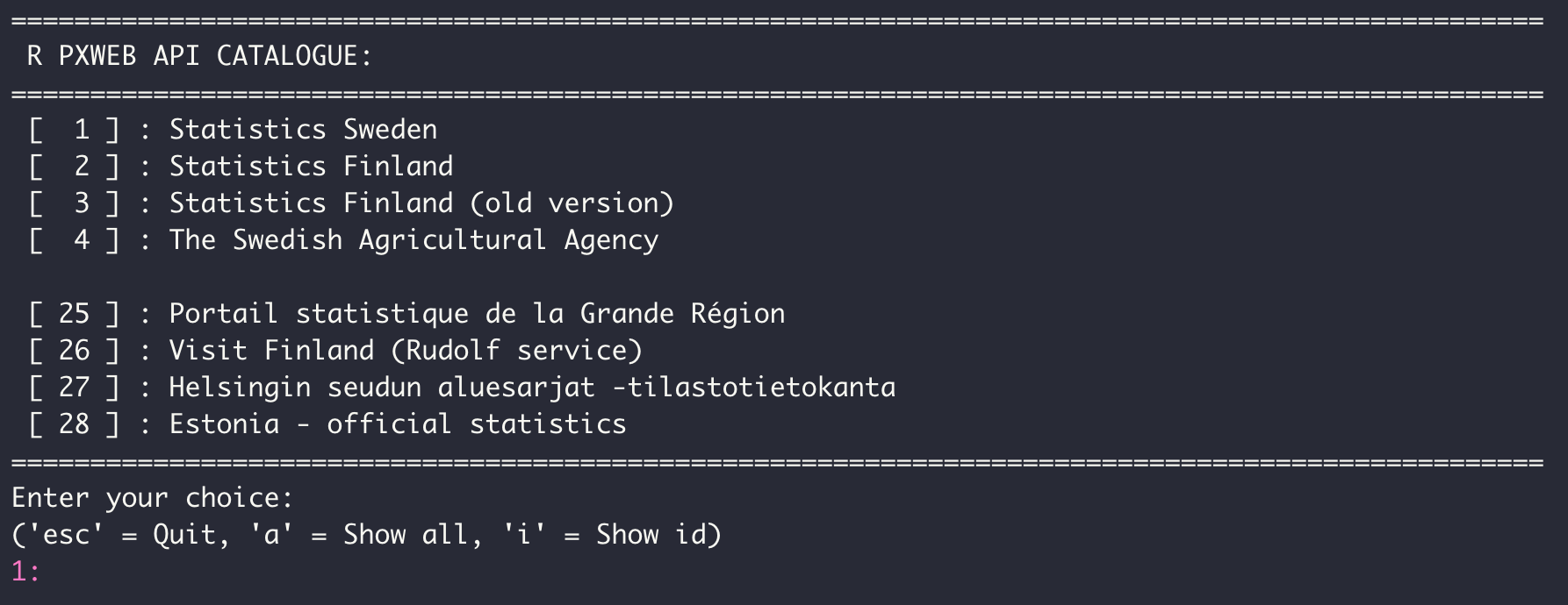
By running pxweb_interactive() you can interactively
choose which data to query. In this case we’re going to use data from
Statistics Sweden.

When you have clicked through which data you want to query you can
get the call to the database as R code. In the code below I have
manipulated the code that was returned by pxweb to only
query county codes that are in
swemaps2::county.
The data queried here is population count with higher education.
library(pxweb)
library(janitor)
library(swemaps2)
library(tidyverse)

pxweb_query_list <-
  list("Region"=county$ln_kod,
       "Kon"=c("1+2"),
       "ContentsCode"=c("BE0101U1"),
       "Tid"=c("2021"))

# Download data
px_data <-
  pxweb_get(url = "https://api.scb.se/OV0104/v1/doris/sv/ssd/BE/BE0101/BE0101C/BefArealTathetKon",
            query = pxweb_query_list)

# Convert to data.frame
px_data_frame <- as.data.frame(px_data, column.name.type = "text", variable.value.type = "text")

population_per_kvm <- px_data_frame |>
  clean_names()
Unfortunately, we do not get the region codes from SCB. But if we
remove the " län from the region names we can join it by
name:
population_per_kvm <- population_per_kvm %>%
mutate(region = str_replace(region, " län", ""))
county_pop <- left_join(county, population_per_kvm, by = c("ln_namn" = "region"))
county_pop
#> Simple feature collection with 21 features and 5 fields
#> Geometry type: MULTIPOLYGON
#> Dimension: XY
#> Bounding box: xmin: 277247.6 ymin: 6133891 xmax: 917271.4 ymax: 7669870
#> Projected CRS: SWEREF99 TM
#> # A tibble: 21 × 6
#> ln_kod ln_namn geometry kon ar invan…¹
#> <chr> <chr> <MULTIPOLYGON [m]> <chr> <chr> <dbl>
#> 1 01 Stockholms (((627791.9 6569168, 630226.6 65721… tota… 2021 371.
#> 2 03 Uppsala (((633496.1 6610607, 632895.2 66095… tota… 2021 48.2
#> 3 04 Södermanlands (((555102.6 6536546, 549484.9 65402… tota… 2021 49.7
#> 4 05 Östergötlands (((496094.6 6443310, 493792.5 64387… tota… 2021 44.5
#> 5 06 Jönköpings (((498999.7 6421417, 500271.5 64171… tota… 2021 35.2
#> 6 07 Kronobergs (((504095.5 6338410, 505156.2 63401… tota… 2021 24.1
#> 7 08 Kalmar (((544656.8 6325506, 540241.9 63273… tota… 2021 22.1
#> 8 09 Gotlands (((706606.9 6415775, 709951.4 64170… tota… 2021 19.5
#> 9 10 Blekinge (((473443 6228381, 472071.2 6231138… tota… 2021 54.2
#> 10 12 Skåne (((420135.8 6254456, 425339.2 62566… tota… 2021 128.
#> # … with 11 more rows, and abbreviated variable name
#> # ¹invanare_per_kvadratkilometerWe can now easily visualize this data on a Swedish map
library(scales)
ggplot(county_pop, aes(fill = log10(invanare_per_kvadratkilometer))) +
  geom_sf() +
  theme_swemap2() +
  scale_fill_viridis_c(option = "magma", labels = number) +
  labs(
    title = "",
    fill = "log10(population\nper square meter)",
    caption = "Source: SCB"
  )
We can also create an interactive map with simplevis
DeSO & RegSO
Using pxweb we can query lots of statistics from SCB on
DeSO level. For example, we might be interested in the proportion of
children with low economic standard in Stockholm. Using
pxweb_interactive() we get a good skeleton of code. Below I
have only changed the code to only query regions that are in
deso_sthlm.
deso <- load_deso()
#> Reading layer `DeSO_2018_v2' from data source
#>   `/private/var/folders/pn/9hhpnpd15_d2k3qp5k814nnh0000gq/T/RtmpPmunBV/deso_2018_2021-10-21/DeSO_2018_v2.gpkg'
#>   using driver `GPKG'
#> Simple feature collection with 5984 features and 7 fields
#> Geometry type: POLYGON
#> Dimension:     XY
#> Bounding box:  xmin: 266646.3 ymin: 6132476 xmax: 920877.4 ymax: 7671055
#> Projected CRS: SWEREF99 TM

deso_sthlm <- deso %>%
  filter(kommunnamn == "Stockholm")

pxweb_query_list <-
  list("Region"= deso_sthlm$deso,
       "Alder"=c("0-19"),
       "ContentsCode"=c("000006TA"),
       "Tid"=c("2019"))

# Download data
px_data <-
  pxweb_get(url = "https://api.scb.se/OV0104/v1/doris/sv/ssd/START/HE/HE0110/HE0110I/TabVX4InkDesoN1",
            query = pxweb_query_list)

# Convert to data.frame
px_sthlm <- as.data.frame(px_data, column.name.type = "text", variable.value.type = "text") %>%
  clean_names() %>%
  as_tibble()

deso_sthlm <- deso_sthlm %>%
  left_join(px_sthlm, by = c("deso" = "region"))
Finally, we can use this data to create a map:
ggplot(deso_sthlm , aes(fill = lag_ekonomisk_standard_procent)) +
  geom_sf() +
  scale_fill_viridis_c(option = "magma") +
  theme_swemap2() +
  labs(
    title = "% Barn med Låg ekonomisk standard",
    subtitle = "Andel personer 0-19 år med låg ekonomisk standard per Demografiskt statistikområde\ni Stockholm stad",
    fill = "% Låg\nekonomisk\nstandard"
  )